A Winter of Mud

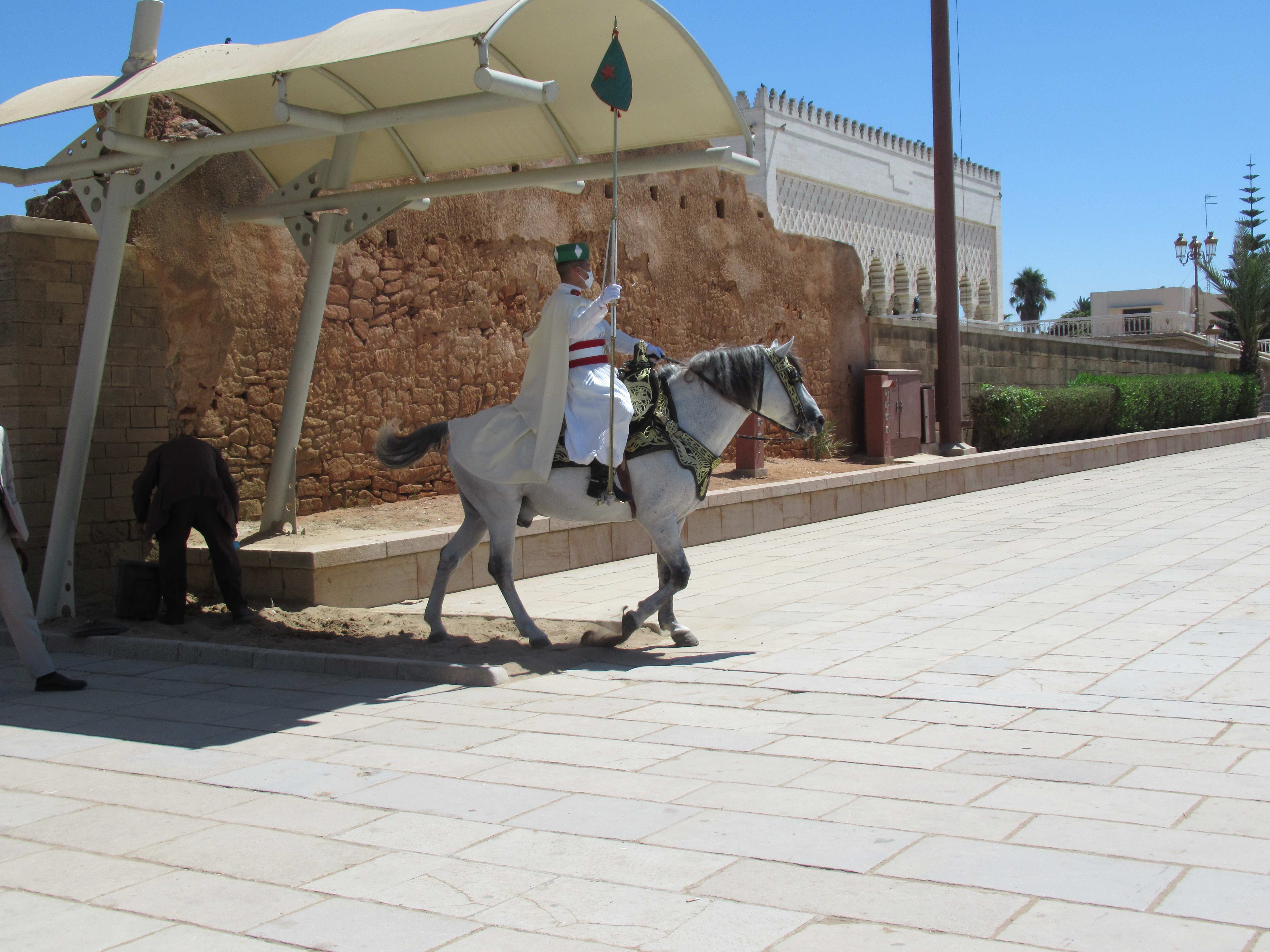
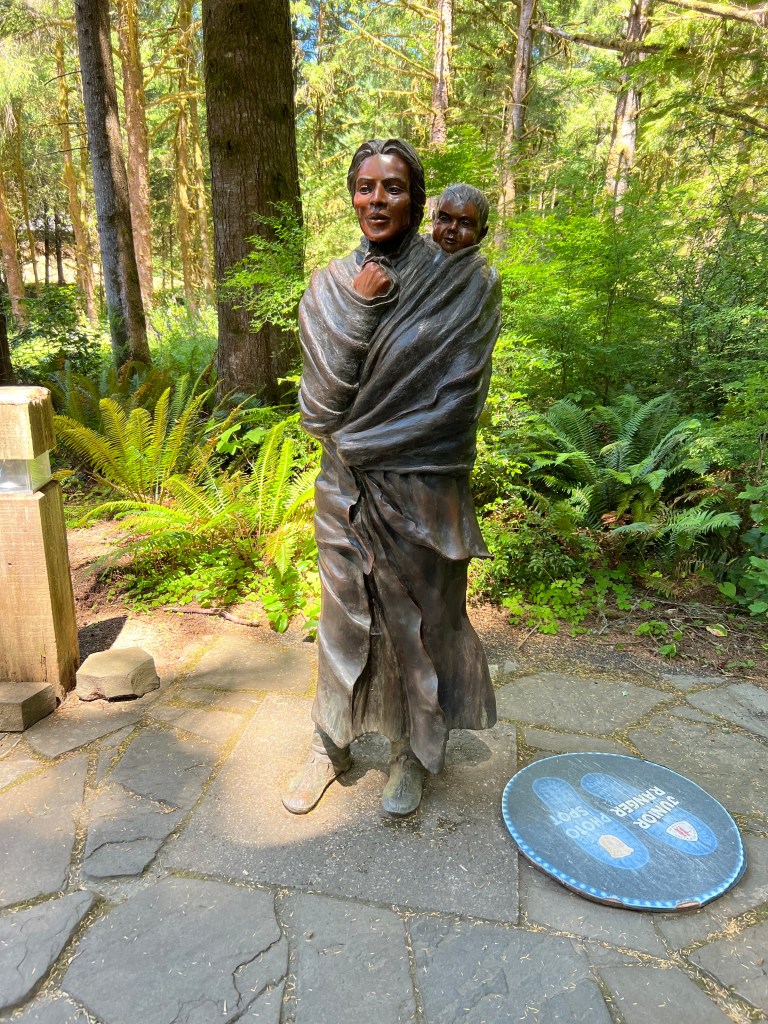
In elementary school, we all learn about the Lewis and Clark expedition, that epic journey of discovery. Most of us have also heard of Sacagawea, and her vital role in the expedition as translator, guide, and ambassador. Less well-known are the living conditions of the company. Since I’m especially interested in women’s contributions to history I find Sacagawea’s story fascinating, not just because of the important guidance she gave the captains, but also because of her skill as a mother.

Sacagawea and her son, Jean-Baptiste Charbonneau, at Fort Clatsop

Remember, Sacagawea was a Shoshoni girl about 10 years old when she was kidnapped by the Hidatsa. She was taken from her home in Idaho to a village near Mandan, North Dakota. There she was sold, along with another girl from her village, to a Frenchman, Toussaint Charbonneau. Charbonneau married both girls, though I have never heard whether or not the girls agreed to the wedding.

In any case, Sacagawea gave birth to their son, Jean-Baptiste Charbonneau (nicknamed Pompey), on February 11, 1805. Less than two months later, on April 5, 1805, the company departed for the west, with Sacagawea carrying her infant son.

Now I’d be the last to suggest that modern parenting is easy. All decisions regarding the health, safety, and future happiness of the child rest on the parent’s shoulders. But today we have disposable diapers, along with innumerable gadgets, equipment, toys, and carrying devices to make caring for an infant easier. Can you imagine setting off on a journey with your child on your back? There were no air-conditioned cars or motels along the way. Sacagawea travelled by foot, horse or open boat the entire journey, and she kept her baby alive.

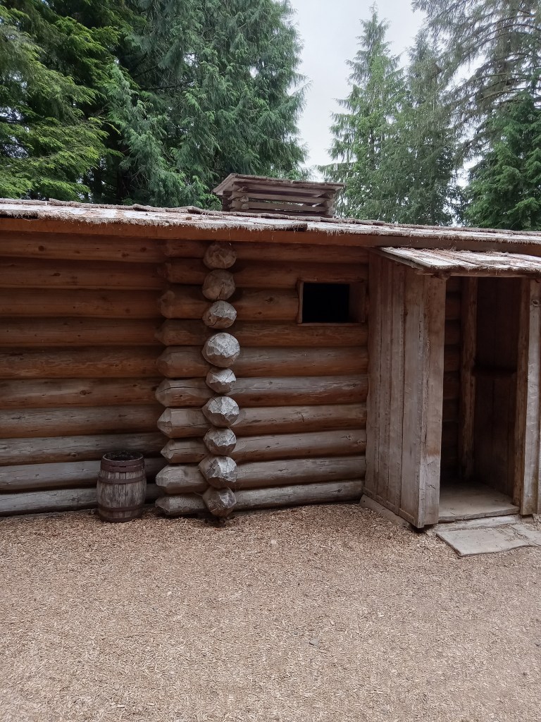
In the winter of 1806, when Pompey was still less than one year old, the Lewis and Clark expedition reached the Pacific Ocean and built Fort Clatsop. They started building on December 8, 1805, and moved in on Christmas Eve, though the roof was not yet finished. Although Sacagawea had a vote in the decision of where to put the fort, I’m sure she never imagined the mud.

Fort Clatsop (reconstruction) Lewis and Clark National Monument, Oregon

Days and days of mud.

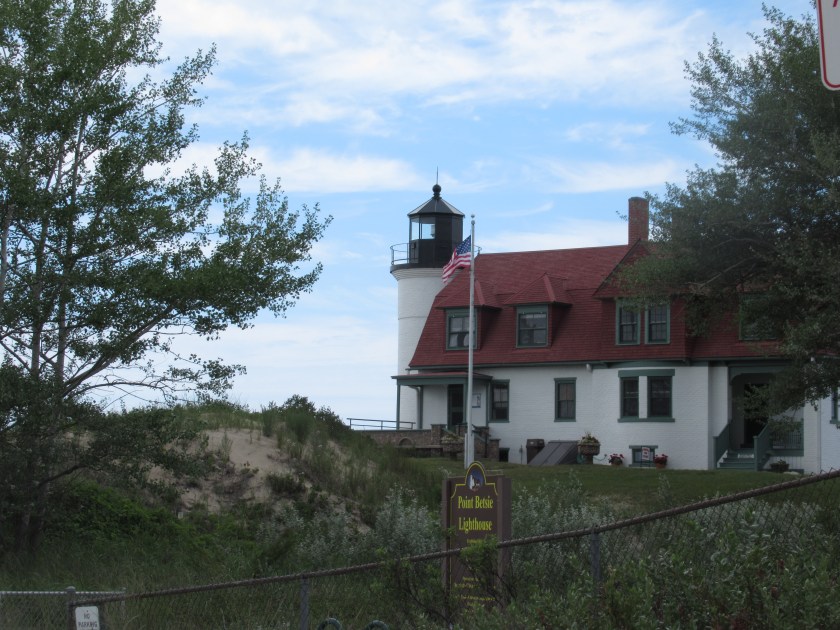
I visited Fort Clatsop on a beautiful, warm and sunny day. The surrounding cedar forest was cool and shady, with a carpet of soft needles lining the paths. The Lewis and Clark expedition had a vastly different experience. Of their three month stay at this fort, it rained all but twelve days.

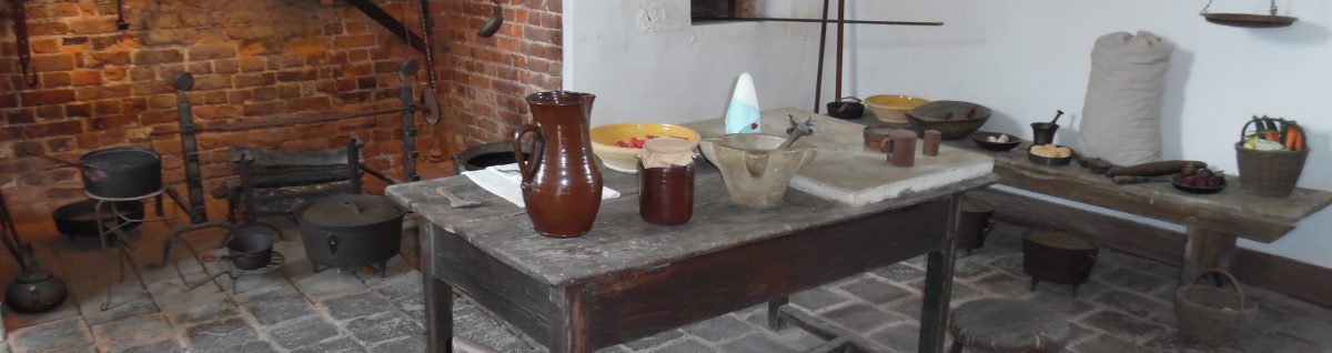
On top of the endless rain, the fort was built for military purposes, not comfort. Thirty two men, one woman, a baby, and a dog lived in the two buildings. The angled roofs were high on the outer edges, and sloped down to a central courtyard. That means all that rain collected in the narrow yard between the buildings. Inside was dark, smoky, and full of fleas. Outside was wet.

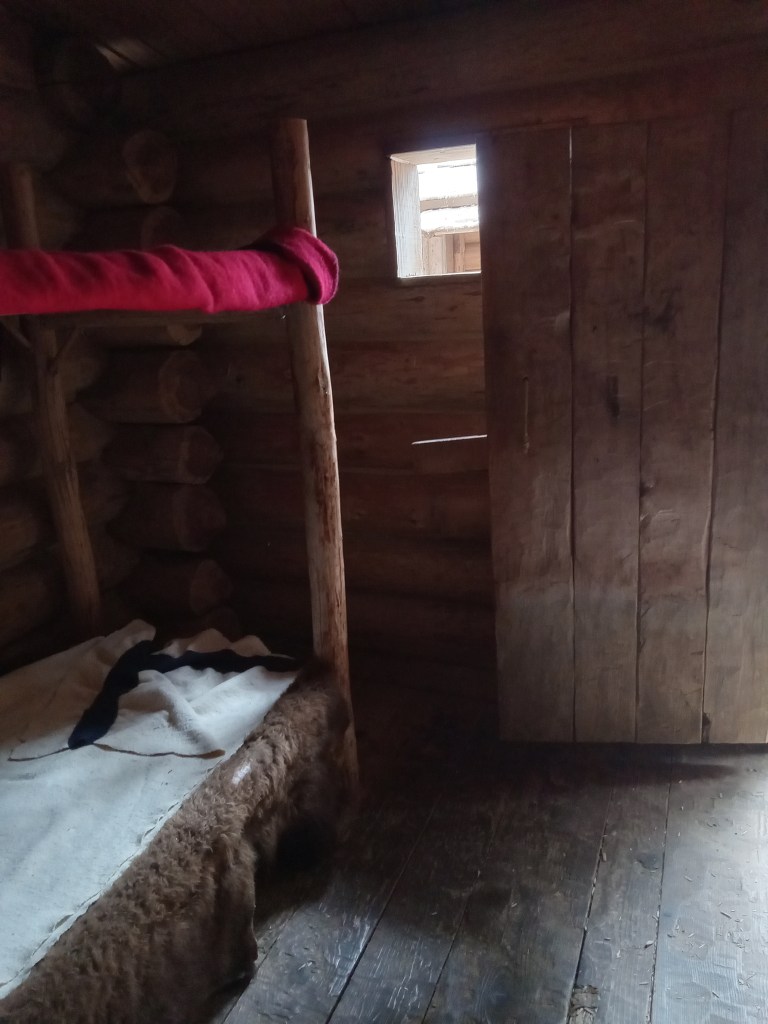
Here Pompy passed his first birthday. He probably crawled about in the mud and played with the men or the dog. He may have spoken his first words and learned to walk. And through it all, Sacagawea kept him healthy.

We learn from the journals Lewis and Clark kept that they left Fort Clatsop on March 23, 1806, as soon as they could. Everyone was tired of this miserable fort. I imagine Sacagawea was just as anxious as the men to leave. The journey back would be long and arduous, but never boring.

Perhaps having a roof over one’s head is not such a luxury where there’s a sea of mud beneath one’s feet.

Nijo-Jo: The Castle that Sings

Let me explain. The great castles of Europe were massive stone structures, built for defense against large groups of marauders. Many are also beautiful, but the aesthetic is not the primary goal. 

On the other hand, while Nijo-jo was also built for defense, beauty, peace, and serenity are equally valued. In this way, it is more like the later, ornate palaces of Europe’s 18th century, built at least in part to show off to other nobles.

Nijo-jo was planned and constructed  in the early 17th century, at the beginning of the Edo period, when Japan was ruled by the Tokugawa family–the Tokugawa shogunate- and Kyoto was the Imperial Capital of Japan. The first shogun of the Tokugawa shogunate, Ieyasu Tokugawa, used it as his residence whenever he was in Kyoto.

Though lighter and airier than some of its European counterparts, Nijo-jo has its share of fortifications. The castle complex has an inner and an outer ring of defense, each ring consisting of a stone wall and  a moat. Originally, the outer wall had four watchtowers, but only two of these remain.  These tall, white buildings with distinctly Japanese curved roofs are landmarks in Kyoto.

Three gates in the outer wall provide access to the Ninomaru area, which includes the Ninomaru palaces and gardens. The five interconnecting buildings of the palace are mostly made of cyprus wood and are decorated with gold leaf. Elegant wall and screen door paintings and ornate carvings were meant to further impress visitors with the shogun’s power and wealth.

There are two gates in the inner wall, leading to the Hon-maru area. When first built, his inner palace was similar to the 1603 Ninomaru palace, but in 1893 some of the buildings from the Katsura Palace in theKyoto Imperial Enclosure were moved here, replacing the older buildings.

Between the inner and outer walls, visitors can stroll through the 400 year old Zen Buddhist gardens. This garden features a small lake, with three islands and several artfully placed stones. 

The most unusual defensive aspect of Nijo-jo are its Nightingale Floors. How are squeaky (singing) floors defensive? Well no one can walk on them without making noise, thus alerting the guards within the castle. The floors were designed so that the nails of the slightly curved floor boards would rub on the joint clamps. It’s possible that the resulting chirping was an accident of design, but I prefer the legend. After all, floors that sing a warning add an aura of magic to an already awe-inspiring place.

The Forces of Empire and Nature

Civilizations come and go. Cities rise and fall. Even great empires flourish for a time, and then inevitably, decline. The Roman Empire, which at its height, stretched from Britain to the Middle East, from northern Europe to West Africa, is a prime example of this cycle. But, fortunately for those of us who love digging into the past, the footprints of those who have gone before us do not disappear into oblivion. Cobbled roads, broken stones, lone archways, and bits of decorated tiles remind the people of today of those past glories.

In the first century AD, in the foothills of Mr. Zerhoun in the Middle Atlas Mountains, Roman colonists, bent on expanding their empire, developed an outpost north of what is now Meknes, Morocco. Colonists pushing into new territory rarely find empty land, and Roman colonists settling the fertile plains surrounding the Khoumane and Fertase? Rivers were no exception. The Amazigh tribes had called this land home since Neolithic times, and the Carthaginans had a city in this spot since the third century BCEBut to the Roman colonists the nomadic and semi-nomadic peoples of the area were ‘Berbers” (barbarians) and the land was perfect for their expansion into Northwest Africa. 

The city the Romans built is called Volubilis. It served as the capital of the Roman province of Mauritania (Land of the Moors). By the third century AD, some 20,000 people called Volubilis home, and Latin was the primary language heard in the streets.

The huge site is now in ruins, the remarkable ability of Roman engineers and artisans is evident in the city plan. The site is only 30% excavated but it is still possible to see the layout of the streets, the public baths and fountains, and the homes of the plebs and the wealthier merchants and officials. These latter homes were elaborate villas with well-preserved, beautiful mosaic tiles floors. The mosaics depict various mythological scenes that give hints of the room’s purpose and insight into Roman sense and sensibilities. The houses are now named by the mosaics found, for example, the House of Orpheus, Dionysus and the Four Seasons, or  the House of the Dog. 

Rome granted the residents of Volubilis Roman citizenship and temporary tax-free status, and the city was able to thrive for a couple hundred years. Eventually, however, pressure from the native Amazigh, and internal issues in Rome, caused Rome to withdraw from the city. Even without Rome’s direct oversight, the multicultural population of Volubilis, comprising Jews, Berbers, Syrians, Greeks, Christians, and Romans, continued to follow Roman practices, speak Latin, and trade in lucrative products such as olive oil.

The Roman influence remained strong for several centuries, until the Arab conquest of North Africa in the seventh century. The Arabs destroyed the churches, and moved the capital from Volubilis to Fes. Though it no longer held a position of prime importance, the city continued to be inhabited for several more centuries. Some buildings were neglected and fell into ruin. Some marble and dressed stone was recommissioned into new projects. 

The remains of the heating system for the Roman public baths

Then, in 1755, the huge Lisbon earthquake devastated the city. Houses crumbled, arches fell, pillars toppled. The forces of nature took only minutes to topple the magnificent legacy of the great Roman Empire..

Today the site is hot and dusty, deserted save for tourists and birds.Grasses and thorn bushes have invaded.  The remaining walls are crumbling. Wind whistles through empty arches. The Romans are gone, as is their empire. The Amazigh no longer live in this ruined city (though they still inhabit the surrounding countryside.) 2000 years after colonization, the war between empire and nature continues. Nature seems bent on taking over, but even after all these years, nature still has not totally erased the memory of the civilization that reigned in these foothills.

The ruins serve to remind the people of today that all things, even Great Empires such as Rome, are ephemeral. We of America should probably keep that in mind.

Bon Voyage: Morocco

Rabat

Recently, I’ve come back from a trip to Morocco. On my departure and my return, I was blessed with well-wishes from family and friends. “Safe travels,” they said with a heartfelt hug ( or the more grammatically grating, ‘Travel safe’). As I smiled and returned their hugs, it occurred to me to wonder, when did ‘safe travels’ replace ‘bon voyage’ as the wish given a traveler? As if the inherent danger of travel is of more concern (or interest?) than the desire for  good times.

I have no clear answer to this, though I suspect the 9/11 attack had a profound effect on our national psyche.

In any case, in spite of the exotic impression people might have of Morocco, the country is remarkably safe. There are, of course, pickpockets, such as a traveler will find in any tourist spot, and there are some disputes over the country’s borders. However, I found the people very helpful and friendly. Morocco is an amazing country, with a fascinating history. The melange of cultures creates a multi-layered society; a predominately Muslim country, where Christians, Jews, Muslims, and people with any other beliefs, live together in peace.

Moroccan culture has developed over the centuries with many different influences. The area has been inhabited at least since Neolithic times. Various indigenous tribes developed a thriving civilization with their own writing and a strong trade relationship with the Phoenicians and later, Carthage. The descendants of these earliest inhabitants call themselves Amazigh (plural Imazighn), which comprise several different groups including the Tuareg. The Romans called them Mauri (which became Moors) or Berbers (which meant barbarians.) 

By 300 BCE the kingdom of Mauretania developed. Mauretania was an independent Berber kingdom. The bustling trade possibilities and fertile lands of North Africa enticed Romans to expand into the areas, though they controlled mostly by trade networks rather than military expansion.  By 33 BCE, the area was considered first a client of Rome, and later a vassal state. The fertile lands of Morocco helped feed the teeming population of Rome.

Christianity moved into Morocco in the 2nd century CE. Rome’s influence waned with the incursions of Vandals, Goths, and Visigoths, who eventually caused the Fall of Rome. By the 4th century CE most of the Romanized area had converted to Christianity. Many Jews lived in the area also.

Beginning around 700 CE, Arabs swept across Northern Africa, gradually converting most of the indigenous population to Islam. The Arab/Berber dynasties of Morocco developed with Arab and Amazigh leaders. Morocco was never controlled by the Ottoman Empire.

As Europe looked for expansion, the Portuguese, Spanish, and French fought for control of the area. Morocco became a French protectorate in 1912 and regained independence in 1956.

Over the centuries, these merging cultures have formed the fabric of modern Morocco, a delightful kaleidoscope encompassing a land as varied as its people. From the dry desert dunes and date palm oases  to the cedar forests and rocky slopes of the high Atlas, from the winding alleys of the old medinas to the smooth, sweeping sand beaches of the north Atlantic, Morocco invites and welcomes visitors to this intriguing land. A place for safe and good travels! Bon voyage indeed!

There is a wide variety of animals, as well as people, in Morocco!

Who gets to be the hero?

500 years ago in 1522, the last (and only remaining) ship of Magellen’s famous circumnavigation of the earth limped into port in Sanlúcar, Spain. Magellan, a Portuguese captain, had begun the journey, which was financed by Spain, three years earlier with five ships and about 270 men. 

A replica of the Nao Trinidad at the Tall Ship Festival in Two Harbors, Minnesota, August 2022

Ferdinand Magellan is the most famous participant in this remarkable voyage. After all, he planned the entire trip, led the five ships across the Atlantic Ocean, kept the fleet intact through two attempted mutinies, discovered the strait of Magellan at the southernmost tip of South America, and carried on across the Pacific. 

However, neither Magellan nor his flagship, the Nao Trinidad, completed the entire journey. Magellan’s first bad turn of luck was when one of his ships wrecked on the east coast of South America. Things got even worse when one of the would-be mutineers, Juan de Cartagena, deserted with another ship. That left only three ships in the fleet to cross the Pacific Ocean, arriving near Guam in March of 1521. Further troubles met the expedition as they fought with the natives of Guan and the Philippines. Magellan was killed in the battle of Mactan. (Lapu Lapu, the leader of the Philippine forces is considered a national hero in the Philippines for his resistance to Spanish colonization efforts.)

In spite of Magellan’s death, the expedition continued, though since only about 115 of the original 227 remained alive, one more ship was abandoned and burned. That left two ships, the Victoria and the Trinidad. It was decided that the Trinidad, which was in poor shape, would return home the way they had come, turning back east to cross the Pacific, while the Victoria would continue west through the Indian Ocean and around the Cape of Good Hope.

Both ships ran into trouble on their routes. The Trinidad was captured by the Portuguese and its crew held for ransom. (The Portuguese were angry at Spain’s encroachment on what they considered their spice trade.) While in Portuguese hands, the ship was wrecked in a storm.

Nao Trinidad (replica)
Nao is the Portuguese word for the type of ship–called a carrack in English.

The Victoria, captained by Juan Sebastián Elcano, carried some 26 tons of cloves and cinnamon, but not enough food for the journey. Twenty of the crew died of starvation. The ship also ran into trouble from the Portuguese, but managed to escape with their cargo and return to Spain. Only 18 of the original 270 men survived the whole journey.

As I said earlier, Magellan is widely regarded as the leader of the first successful circumnavigation of the globe. However, why he gets this honor is a bit of a mystery to me. 

After all, he didn’t make it home. Also, he was not a popular person back in Spain, nor was he held in high esteem in his native Portugal. Juan de Cartegena, the mutineer-deserter, had returned safely to Spain, where he sset about assiduously besmirching Magellan’s name (partly in an effort to keep himself and his mutineering crew out of jail).. Among other things, he accused Magellan of disloyalty to Spain. Since the Spanish Crown already had their doubts about Magellan’s motives since he was Portuguese, Cartagena’s tales were easily believed. In fact, Magellan’s wife and son were put under house arrest. 

As far as the Portuguese were concerned, Magellan was nothing more than a traitor because he sailed under Spanish auspices. (To be fair, Portugal had denied him funding, whereas Spain agreed to finance the voyage.)

In any case, with both sides against him, and his death in the Philippines, it is rather surprising that he’s the one we remember.

Elcano seems the more likely candidate for the role of hero. After all, he, along with only eighteen of the original crew, finished the journey, bringing with them a valuable cargo of spices. But Elcano was Basque, not Spanish, and the Spanish Crown feared Basque nationalist sentiment. (Yes, tensions between the Basque and the rest of Spain are at least 500 years old!). In any case, his accomplishment was not highly celebrated at the time, and he has been largely ignored since then. (However that seems to be changing a bit now as history gets ‘updated’ and more inclusive.)

In the end, the real hero of the whole expedition is Antonio Pigafetta. He started with Magellan and finished with Elcano, and kept a journal throughout the voyage. His account is the most complete story of what happened. He may be fairly unknown, but his words have outlived kings, and sailors, and explorers.  That’s power.

Riding the Rails West:

Thoughts on Glacier National Park

A recent trip to Glacier National Park brought into focus an unexpected insight into the symbiotic relationship between national parks and trains, along with a sobering note regarding Western expansion. 

Over a hundred years ago in 1893,  the Great Northern Railway finished laying tracks for the northernmost rail route in the United States westward from St. Paul to Seattle. The developers chose the route over the Rockies carefully, using one of the flattest and most accessible passes. Then, in a concentrated effort to promote rail business for tourists as well as farmers, the Great Northern Railway pushed hard to establish a national park in Montana, well aware that such a designation would encourage folks from all over the United States to visit. Thus financial reasons more than environmental concerns played a major factor in the park’s development.

Glacier Park was established as a national park in 1910, the tenth such park in the United States. The railway made much of the scenic alpine vistas, and further enticed visitors by building chalets and lodges throughout the area.

East Glacier Park Lodge, where we stayed, opened in 1913. The posts are made of huge trees brought in from the west, cedars for the exterior and Douglas fir for the interior of the lobby.  In a misplaced tribute to the native Blackfeet, the developers also erected a few totem poles. (The totem poles are very nice art, but have nothing to do with the indigenous Blackfeet of this area.)

The lodge is only a stone’s throw from the railway station, but they offer a free shuttle between the two, an old style red checker limo (replacing the horse and buggy transport of a hundred years ago.)

Though the lodge looks much the same as it did in 1913, much has changed in visiting it. Train travel now offers far more comforts than the slow, chugging steam engines of the past. We stayed in a private roomette in the sleeper car for the twenty hour trip, with excursions on board to the observation car and the diner, where we enjoyed three meals a day.

Instead of traveling into the park by horseback, we took a shuttle bus to enjoy a cruise on Two Medicine Lake

The next day, a bus tour of part of Going to the Sun Road. (We couldn’t traverse the entire 50 miles, because Logan Pass, the highest point in the park and on the road, was not yet open in early July.) This road is the only one that crosses the entire park. Opening in 1933, the road has been registered as a National Historic Place, a National Historic Landmark, and a Historic Engineering Landmark. 

Many have called the Going to the Sun Road an engineering marvel, designed to preserve the natural habitat. But others have seen it as a scar upon the sacred land that is the backbone of the world. In other words, this road is a poignant reminder that there are at least two sides to every story. On the one hand, the establishment of the railroads and various national parks have preserved and protected for the whole nation this beautiful and remote wilderness. The land provides needed habitat for many species of plants and animals, and tourism provides jobs for area residents, notably members of the Blackfeet tribe, whose reservation abuts the entire eastern side of Glacier National Park.

Native Sculpture marking one entrance to Blackfeet Reservation

On the other hand, many of the Blackfeet people believe the park land was taken from them illegally. Historically, the whole area was the homeland of all three bands of Blackfeet. In 1895, the tribe faced starvation, caused by many factors including the demise of the buffalo. In desperation, some of the leaders sold the land that would become the park for 1.5 million dollars, but in the agreement, they retained the right to hunt, fish, log, and forage on the land. When the ceded land became a park in 1910, the United States government reneged on the agreement, claiming the area as federal property, no longer belonging to the Blackfeet in any way.

Aster Falls

This is  a sad and disturbing story, though unfortunately it is not an unusual or surprising one, because it has happened so many times in what is now the United States. But the story serves as a stark reminder of the debt we owe to the indigenous people of this land, and the responsibility we all have to provide good stewardship for this very special place. Like the tenacious bear grass that blooms once in seven years, let the land and the people endure.

Announcing…

This month I’m deviating a bit from my usual blog to celebrate Irish legend and Irish places. And celebrate two books I have coming out in the next few months.

First up, is Ireland: You Can’t Miss It. This collection of essays, photographs, and poems offers my impressions of Ireland. In it, it share stories of my own travels, along with the legends and myths of many memorable places. Part memoir, part travelogue, this celebration of Ireland is sure to delight anyone. (No Irish heritage required.)

Some of the places featured in this book are ones I wrote about in this blog previously. For instance:

The second book I’m celebrating is Finn McCool and the Giant’s Causeway. This story features one of my favorite Irish heroes (Finn McCool) and his clever wife (Oona) at one of my favorite place in Northern Ireland (The Giant’s Causeway).

Ireland: You Can’t Miss It will be available from my website http://www.terrikarsten.com or from Amazon on May 25.

Finn McCool and the Giant’s Causeway will be available from my website http://www.terrikarsten.com or from Amazon on August 10.

Take and look and enjoy celebrating Ireland with me.

Remember the Alamo!

Examining the Legend

Davy Crockett at the Alamo

As a child I idolized Davy Crockett and Daniel Boone, especially as portrayed by Fess Parker on television and transformed into legend by American Frontier lore and tall tales.

In my mind, they lived at the same time (the ‘old days’) Both wore coonskin caps, alternately fought and befriended Indians, and lived on the wild frontier (which I thought was somewhere vaguely west).  In reality, Boone (1734-1820) was born almost fifty years before Crocket (1786-1836) and died sixteen years earlier. Both were politicians as well as frontiersmen. Daniel Boone fought in the Revolutionary War, and lived to tell the tales. Davy Crockett fought in the Texas War for Independence, and died at the Alamo.

Back then, Crockett’s death always struck me as particularly tragic– a young adventurer struck down in his prime. I read of his exploits as a legendary hero, killed fighting for liberty. It was romantic (in the Byronic sense). And because of my interest (obsession?) with Davy Crockett, I became fascinated by the stories of the Alamo, the site of the most famous battle for Texan independence. I read of the heroic stand made by a handful of American heroes who all died protecting Texas from the cruel Mexican army invaders. Like Crocket’s own larger-than life tale, the stories I heard of the Alamo stretch the truth into more legend than fact.

The Alamo

I had an opportunity in December to visit the Alamo in San Antonio, Texas.  On a warm sunny day, I stood in line with a couple hundred people for a timed entrance ticket. The place was crowded, in spite of Covid-19 restrictions limiting access. As I wandered through the well-laid out exhibit hall, the shaded gardens, and the white, limestone church, I learned more of the true history of the place.

What is now known as the Alamo was built in 1744-1758, as a Spanish mission (Mision San Antonio de Valero) with the purpose of ‘educating’ (converting) the Indians. Much of the building collapsed before it was finished.Still, it was used as a mission and church until 1793, when it was abandoned. In 1803, ten years later, the compound became a fortress which came to be known as the Alamo, meaning ‘cottonwood’ in Spanish. This fairly small, fairly obscure, place gained its fame from the battle fought there in 1836.

The early 1800’s were a time of great upheaval for Mexico, which included Texas at that time. Mexico’s war to separate from Spain lasted for years, with Spain only recognizing Mexico’s independence in 1836. Because of the riches in Mexico (ie silver), the opportunities for trade and good lands, many Anglo-Americans moved out of the United States and into Texas during this period.

Susanna Dickinson and daughter Angelina survived the Battle of the Alamo

Mexico’s government grew less and less tolerant of these Anglo immigrants (called Texians). Texians, in turn, chafed under Mexican rule. One among many grievances was that Mexico had abolished slavery in 1830. The Texians did not want to give up their ‘property’. Throughout 1835, the Texians, along with many volunteers from the United States, and some ‘Tejanos’ (Mexican citizens of Texas), defeated several small Mexican garrisons in Texas. But the resulting government was disorganized and ineffective. General Santa Ana vowed to defeat these rebels once and for all. With a huge army, Santa Ana met the Texian contingent at the Alamo and defeated them, killing nearly all of the Alamo defenders. (The women, children, some Mexican citizens, and slaves were released. Survivors who surrendered were executed.)

This battle served to rally the Texian Army, and they went on to soundly defeat Santa Ana. The winners declared the land was now independent, the Republic of Texas. However, Mexico, enraged at what they saw as U.S. interference in their land, refused to recognize the Republic of Texas.  The U.S. annexation of Texas as the 28th state in 1845 led to the Mexican-America War.

In spite of the legends proclaiming their heroism, the defenders of the Alamo could be considered an immigrant take-over of Mexican land, not the heroic last stand of a people fighting invaders. History is often the stories told by the winners. In this case, although the Texians lost at the Alamo, they later won the war, giving them the power to reshape the telling to their advantage. The story of the Alamo should probably be taken as a cautionary tale: legends can lie.

The Lure of the Light

A few lighthouses along Michigan’s shore

I am a pharophilo. For as long as I can remember, lighthouses have fascinated me. I’m not sure why. Maybe it’s the romanticized drama of a secluded tower shining a light to aid travelers. Maybe it’s the association with wild storms and crashing seas. Maybe it’s the thrill of climbing round and round to the top and stepping out on the balcony to feel the wind. Whatever the reason, I make it a point to visit lighthouses whenever I have a chance. The summer of 2021, I spent a week with my siblings in Manistee, Michigan. With shoreline on four of the five Great Lakes (Superior, Michigan, Huron, and Erie), Michigan has at least 120 lighthouses, more than any other state. During my stay in Manistee, I managed to visit five of them.

Manistee North Pierhead Lighthouse

The north pierhead light in Manistee is cast iron, built in 1927. Shown here is the catwalk used to access the light in rough weather. It is one of only four such catwalks still existing in Michigan.

Point Betsie Light

Point Betsie’s Lighthouse and keeper’s residence were built in 1858. The name comes from the French translation of the native name of a nearby river. In French, the name was Pointe Aux Becs Scies (meaning Sawbill Point). Later speakers modified the ‘Becs Scies’ to Betsie. Originally, the tower was a cream-colored brick, but it was painted white in 1900 to help make it visible by day.

Big Sable Point

Petite pointe au sable

Petite Pointe au Sable (or Little Sable) Lighthouse was built in 1874 amid the towering sand dunes of the area south of Luddington. Like the Big Sable tower north of Luddington, this tower is also over 100 feet tall. It still has its original third order Fresnel lens.

Luddington North Breakwater Light

The Luddington North Breakwater light, built in 1924, features an unusual design of steel and reinforced concrete. It is 57 feet tall. The light can be accessed by a half-mile walk along the concrete pier. It was fully automated in 1972.

Getting to the Other Side: Menor’s Ferry

Teton National Park

Ready to Launch

Although many of us can swim, water is not the natural habitat for humans. But for people, like for the proverbial chicken faced with a road, the urge to cross is overwhelming. A restless bunch, we humans are forever trying to get to the other side, where the grass just might be greener.

Rivers pose a particular difficulty in the face of this insatiable desire to go on, travel forth, get to that other side (and often back again.) Instrumental for long distance transportation and as a source of water, rivers offer ideal places to settle. Soon, homes and work, food and safety can develop on opposite banks. Short of swimming, there are only a limited number of ways one can cross. If a place that is shallow and smooth bottomed can be found, the river might be forded, which means wading, riding, or driving a wagon across. Rougher rivers require a bridge or a ferry. Bridges take time, money, and skill to build. That means that from ancient times and in countless tales, the ferry is of utmost importance.

For instance, Charon of Greek mythology, ferries the dead across the River Styx. Urshanabi is the Mesopotamian equivalent, ferrying the dead across the River Huber.

Far more recent, and much less lethal, is Menor’s Ferry, built in 1894 to cross the Snake River in Jackson Hole, Wyoming. William (Bill) Menor took advantage of the Homestead Act of 1862 to ‘squat’ on 149 acres on the west side of the river. (He secured legal title in 1908.) Most settlers, including Bill Menor’s brother, Holiday Menor, settled on the east side of the river. The  Snake River had a few fords, but these became impassable whenever the water was high. Menor’s Ferry soon became the most reliable way to cross, allowing residents of Jackson Hole to hunt, forage, and cut lumber in the mountain foothills on the west side. A wagon and team cost fifty cents for the crossing, while a horse and rider cost half that. Menor didn’t charge pedestrians, as long as there was a wagon crossing. 

Menor’s Ferry is an ingenious design. The platform, large enough for a wagon and team, floats on two pontoons. The ferry is attached to a  cable overhead to prevent it being carried downstream by the strong current of the river. The ferry can be angled toward the opposite bank by means of the pilot wheel, which tightens the rope to point the pontoons in the right direction. The force of the current pushes against the pontoons, driving the ferry across the river, much like a sailboat angling the sails to take advantage of the pressure of the wind. Although Charon’s Ferry is usually depicted as being poled across the river, the type of ferry Menor built was known in ancient times and in many places.

The Snake River can be wild and erratic at times, but at other times the level of the untamed river dropped too low to operate the ferry. Menor rigged up a suspended platform from his cable system, and transported up to four passengers across in this makeshift cable car. In winter, Menor and his neighbors cooperated to build a temporary bridge for crossing. The bridge was taken down each spring.

Menor operated the ferry until 1918, when he sold it to Maude Noble. An astute business woman, she  immediately doubled the prices. By this time, cars were bringing more and more tourists into Jackson Hole. In another bid for increased revenue, she charged $1.00 for cars with Wyoming license plates, and $2.00 for out of state plates. Maude operated the ferry for almost 10 years, until 1927 when a steel truss bridge was built. Although the urge to get to cross never went away, Menor’s Ferry became obsolete with the completion of the bridge.

Bill Menor’s ferry and homestead are now a part of Grand Teton National Park, a tribute to the men and women who made it possible to get to the other side.